Drones are mapping Indian cities to update old land records

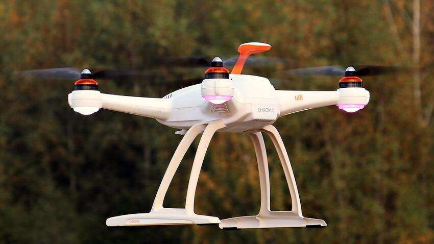
Officials in one of India`s fastest growing cities are using unmanned aerial vehicles (UAVs) to update land records in a pilot project that could be rolled out across the country if rules governing the use of drones were simpler, authorities said.
Haryana state`s Project Udaan, or flight, is mapping the technology hub of Gurgaon, a satellite town of Delhi, and the towns of Sohna and Manesar in northern India.
The drone images are being used to update decades-old land records, check encroachments and resolve disputes over land and property.
"While land records are meant to be updated every five years, this is not done regularly and there are invariably errors, even with satellite imagery," said T.L. Satyaprakash, deputy commissioner in Gurgaon.
"That is why we are using drones, as they are more precise. So we can verify and rectify the land records before they are digitised," he told the Thomson Reuters Foundation.
India has embarked on a land record modernisation programme to survey lands, upgrade records and establish ownership. The project is scheduled to conclude in 2021 at a cost of 110 billion rupees ($1.6 billion).
Delays in mapping lands and authenticating ownership have caused disputes that stall development projects, sparking lengthy court battles. Matters related to land and property make up about two thirds of all civil cases in India, according to Daksh, a legal advocacy group based in Bengaluru.
Haryana state officials sourced drones from Science and Technology Park, Pune to take high-resolution images every three months to record boundaries, illegal constructions and encroachments of forests and public lands, Satyaprakash said.
These images were then checked against existing land records and verified with village councils in rural areas before being updated, said R.S. Hooda, chief engineer at Haryana Space Applications Centre, which is also working on the project.
"Drones are cheaper now compared to some years ago, as they are being made in India, and the images are far superior to satellite images," he said.
"This project can be replicated elsewhere quite easily, but the guidelines for drone use are rather strict, including where they can fly, so their use is limited."
Drones are increasingly used in India to curb deforestation and check illegal mining and quarrying.
But rules governing their use differ in every state, with permissions needed from the local police and the defence ministry to operate them, Hooda said.
The Directorate General of Civil Aviation issued a draft policy on the use of civilian UAVs earlier this year, which said all UAVs must be registered and that permits to operate them would be issued on a "case to case basis".
Drones are barred from flying over certain areas, including military facilities, the entire air space over Delhi, and near international borders.
"It is a challenge - if it were a little easier to use drones, we can map more areas quickly. We can do so much more in land-related matters with drones," Hooda said.
Get Latest Business News, Stock Market Updates and Videos; Check your tax outgo through Income Tax Calculator and save money through our Personal Finance coverage. Check Business Breaking News Live on Zee Business Twitter and Facebook. Subscribe on YouTube.
RECOMMENDED STORIES

Small SIP, Big Impact: Rs 1,111 monthly SIP for 40 years, Rs 11,111 for 20 years or Rs 22,222 for 10 years, which do you think works best?

SBI 444-day FD vs PNB 400-day FD: Here's what general and senior citizens will get in maturity on Rs 3.5 lakh and 7 lakh investments in special FDs?

SCSS vs FD: Which guaranteed return scheme will give you more quarterly income on Rs 20,00,000 investment?

Looking for short term investment ideas? Analysts suggest buying these 2 stocks for potential gain; check targets

Rs 3,500 Monthly SIP for 35 years vs Rs 35,000 Monthly SIP for 16 Years: Which can give you higher corpus in long term? See calculations
05:30 PM IST


 MS Dhoni-backed drone manufacturer aims to sell 50,000 agri and consumer drones in next few years
  IG Drones redefines boundaries: Expanding its expertise in the field of security and surveillance
  Govt notifies operational guidelines for drone PLI scheme
 Navy to soon induct Varuna, India's first human-carrying drone– How it works!
  Drone delivery and logistics startup Zipline hires Indian-origin former Tesla veteran Deepak Ahuja