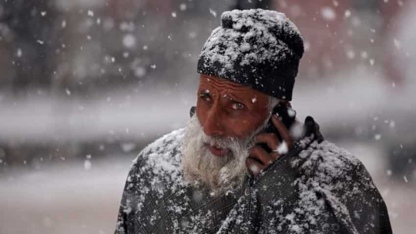
Weather today and outlook: Bad luck! Big freeze in north India to continue due to cold wave, says IMD; rainfall expected in Tamil Nadu, Kerala
Weather today and outlook: As per the National Weather Forecasting Centre of the India Meteorological Department (IMD), cold wave to severe cold wave conditions would occur in some pockets of Punjab, Haryana, Chandigarh, West Uttar Pradesh and north Rajasthan during first half of the 1st week and decrease thereafter

Weather today and outlook: As per the National Weather Forecasting Centre of the India Meteorological Department (IMD), cold wave to severe cold wave conditions would occur in some pockets of Punjab, Haryana, Chandigarh, West Uttar Pradesh and north Rajasthan during first half of the 1st week and decrease thereafter. During week 2, there would be slight rise in minimum temperatures as compared to week 1.
“Isolated heavy to very heavy rainfall very likely over Tamil Nadu, Puducherry & Karaikal on 18th & 19th December and over Kerala &Mahe on 18th December and over Lakshadweep on 19th & 20th December,” said a weather bulletin released by Ministry of Earth Sciences
A fresh feeble Western Disturbance is very likely to cause light rain/snow over Western Himalayan region on 20th & 21st December, it said.
Here is everything you need to know about the weather in the coming two weeks, so that you can keep yourselves safe from vagaries of cold weather.
Weather today and outlook for North India, Tamil Nadu, Kerala:
*Forecast for next two weeks weather systems & associated Precipitation during Week 1 (17 to 23 December, 2020) and Week 2 (24 to 30 December, 2020) Rainfall for week 1: (17 to 23 December, 2020)
*Under the influence of the easterly wave, scattered to fairly widespread rain/thundershowers very likely over Tamil Nadu, Puducherry, Karaikal, Kerala, Mahe and Lakshadweep area during next 3 days. Isolated heavy to very heavy rainfall very likely over Tamil Nadu, Puducherry, Karaikal on 17th December and isolated heavy falls on 18th & 19th December and over Kerala, Mahe on 18th December and over Lakshadweep on 19th & 20th December, 2020.
*A fresh feeble Western Disturbance is very likely to cause light rain/snow over Western Himalayan region on 20th & 21st December, 2020.
*No significant rainfall likely over remaining parts of the country during the week
*Cumulatively, above normal rainfall likely over south peninsula and below normal rain/snow likely over Western Himalayan Region during week 1 (Annexure V).
*Rainfall for week 2: (24 to 30 December, 2020)
*Due to the absence of any active Western Disturbance, near normal rain/snow also likely over Western Himalayan Region Under the influence of fresh easterly wave, normal to above normal rainfall activity likely over south peninsula (Annexure V).
*Temperature/fog for week 1 & 2: (17 to 30 December, 2020)
*Minimum temperatures are between 2.0°C to 6.0°C over most parts of northwest India. These are markedly below normal (-5.0°C or less) at isolated places over Jammu & Kashmir, Ladakh, Gilgit-Baltistan & Muzaffarabad and Himachal Pradesh; appreciably below normal (-3.1°C to -5.0°C) at a few places over West Rajasthan and West Uttar Pradesh and at isolated places over East Rajasthan, East Uttar Pradesh, Saurashtra & Kutch and Haryana, Chandigarh & Delhi; below normal (-1.6°C to -3.0°C) at a few places over Punjab and Uttarakhand.
*No significant change in minimum and maximum temperatures would occur over Northwest India during next 2 days and rise by 2-3°C in minimum temperatures and 5-6°C in maximum temperatures during subsequent 3 days. Fall in minimum temperatures by 3-5°C would occur over East Madhya Pradesh, Vidharbha and Chhattisgarh and by 4-6°C over East India during first half of the 1st week. Fall in minimum temperatures by 2-3°C would occur over West India during next 2 days.
*Overall week as a whole, the minimum temperatures would be below normal by 2-6°C over most parts of northwest, central & east India and near normal or slightly above normal over remaining parts of the country during week 1.
*Cold Wave to Severe Cold Wave conditions would occur in some pockets over Punjab, Haryana & Chandigarh, West Uttar Pradesh and north Rajasthan during first half of the 1st week and decrease thereafter.
*Cold Day to Severe Cold Day conditions would occur in some to many pockets over Punjab, Haryana, Chandigarh & Delhi, north Rajasthan and northwest Uttar Pradesh during next 2 days and abate thereafter.
*During week 2, there would be slight rise in minimum temperatures as compare to week 1. However, the minimum temperatures would be below normal by 2-4°C over most parts of northwest, central & east India and near normal or slightly above normal over remaining parts of the country (Annexure VI).
Cyclogenesis:
There is low probability of cyclogenesis over south Andaman Sea and adjoining southeast Bay of Bengal during first half of week 2.
See Zee Business Live TV Streaming Below:
Get Latest Business News, Stock Market Updates and Videos; Check your tax outgo through Income Tax Calculator and save money through our Personal Finance coverage. Check Business Breaking News Live on Zee Business Twitter and Facebook. Subscribe on YouTube.
RECOMMENDED STORIES

SBI 444-day FD vs PNB 400-day FD: Here's what general and senior citizens will get in maturity on Rs 3.5 lakh and 7 lakh investments in special FDs?

Small SIP, Big Impact: Rs 1,111 monthly SIP for 40 years, Rs 11,111 for 20 years or Rs 22,222 for 10 years, which do you think works best?

Rs 3,500 Monthly SIP for 35 years vs Rs 35,000 Monthly SIP for 16 Years: Which can give you higher corpus in long term? See calculations

Power of Compounding: How long it will take to build Rs 5 crore corpus with Rs 5,000, Rs 10,000 and Rs 15,000 monthly investments?
06:36 PM IST


 IMD predicts severe cold wave to abate Delhi-NCR and other northern states from Sunday – Punjab’s Bhatinda to hit 0.6 degrees
 Heat Wave Alert: Severe heat in north India, temperature crosses 46 degrees
 Monsoon Alert: Pace of the monsoon slows down; will it progress in 10 days? Zee Business report
 Weather today: 'Unusual spell' of cold wave grips North India; learn why
 NCR emerges as affordable housing destination in India